
 Faculty of Science, Technology and Medicine
 Faculty of Law, Economics and Finance
 Faculty of Humanities, Education and Social Sciences
 Interdisciplinary Centre for Security, Reliability and Trust
 Luxembourg Centre for Systems Biomedicine
 Luxembourg Centre for Contemporary and Digital History
 Luxembourg Centre for European Law
 Luxembourg Centre for Socio-Environmental Systems
GR-Atlas – Digital Atlas of the Greater Region
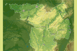
The Atlas of the Greater Region (GR-Atlas) is a collection of interactive thematic maps for the SaarLorLux Greater Region and a web geographic information system (WebGIS), which benefits researchers, as well as schools, residents and tourists. The interdisciplinary atlas covers a broad spectrum of topics, including natural environment, history, economy, society, transport and religion. It also contains unique topics like fuel tourism or the perception of the Greater Region in the media.
The project at a glance
-
Start date:25 Nov 2018
-
Duration in months:62
-
Funding:FNR – Luxembourg
-
Principal Investigator(s):Michel PAULY
About
The Atlas of the Greater Region (GR-Atlas) is a collection of interactive thematic maps for the SaarLorLux Greater Region and a web geographic information system (WebGIS), which benefits researchers, as well as schools, residents and tourists. The interdisciplinary atlas covers a broad spectrum of topics, including natural environment, history, economy, society, transport and religion. It also contains unique topics like fuel tourism or the perception of the Greater Region in the media. Users can choose subcategories, whose locations are displayed on the map and icons indicate relevant information, historical data and website links. Notable highlights include time-controlled maps which display the chronological development of a phenomenon: for example how the borders have shifted between 1815 and today. In addition, the ability to combine maps allows one to recognise connections that would hardly have been noticed in the past.
Organisation and Partners
- Department of Geography and Spatial Planning
- Faculty of Humanities, Education and Social Sciences (FHSE)
- Le gouvernement du Grand-Duché de Luxembourg
- Luxembourg Institute of Science and Technology (LIST)
- Université de Lorraine
- Université de la Sarre
- Université de Trier
- Université de Liège
- Musée National d'Histoire Naturelle
Project team
- Michel PAULY, PI
Keywords
- maps
- borders
- connections