
 Faculty of Science, Technology and Medicine
 Faculty of Law, Economics and Finance
 Faculty of Humanities, Education and Social Sciences
 Interdisciplinary Centre for Security, Reliability and Trust
 Luxembourg Centre for Systems Biomedicine
 Luxembourg Centre for Contemporary and Digital History
 Luxembourg Centre for European Law
 Luxembourg Centre for Socio-Environmental Systems
Advanced asymmetry tropospheric products for meteorology from GNSS and SAR observations (VAPOUR)
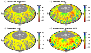
The project addresses GNSS multipath effects on slant delay estimates, making these more useful for assimilation by numerical weather models.
The project at a glance
-
Start date:01 Feb 2019
-
Duration in months:36
-
Funding:FNR
-
Principal Investigator(s):Félicia Norma Rebecca TEFERLE
About
The VAPOUR project aims to advance meteorological forecasting and climate analysis on both national and international scales by developing next-generation space-geodetic tropospheric products, including Slant Total Delay (STD), Zenith Total Delay (ZTD), and gradients (GRD). Utilizing observations from the Global Navigation Satellite System (GNSS), including the European Galileo, and Synthetic Aperture Radar Interferometry (InSAR) data from missions like Copernicus Sentinel, VAPOUR builds on extensive research and expertise from prior host-, FNR-, and EU-funded projects. This initiative focuses on enhancing the representation of atmospheric water vapor, a key component in weather systems and a major greenhouse gas, in numerical weather prediction (NWP) models. Traditional GNSS-derived tropospheric products often fail to address spatial variations accurately and are prone to issues like multipath effects; VAPOUR seeks to rectify these shortcomings through the analysis of multi-GNSS data and the integration of SAR-derived water vapor maps. These maps will provide high-resolution data to improve weather forecasting tools. European meteorological services, including MétéoFrance, already incorporate real-time GNSS data like GPS-derived ZTD into their NWP models for timely weather event analysis. VAPOUR’s innovative approach is set to refine these models by introducing high-resolution STD and GRD products that account for slanted-anisotropic delays, offering significant improvements over current models. Furthermore, the project will address the challenges posed by multipath errors by developing new techniques for their mitigation, enhancing the quality of slant water vapor measurements. By integrating advanced tropospheric products into operational forecasting systems, such as those used by MétéoFrance and MétéoLux, VAPOUR will enhance the accuracy of weather predictions and provide valuable insights into storm dynamics and other atmospheric phenomena. In addition to GNSS data, VAPOUR will leverage SAR data, traditionally seen as problematic due to atmospheric delays, by turning these into an asset for cross-validation of GNSS-derived products. This will establish a robust framework for future SAR missions to contribute more effectively to routine weather forecasting.
Organisation and Partners
Gunnar Elgered, Chalmers
University of Technology
Ramon Hanssen,Technical
University Delft
Tim Springer, PosiTim
Jan Dousa, Geodetic
Observatory Pecny
Project team


Sebastien Varette