Faculty of Science, Technology and Medicine
 Faculty of Law, Economics and Finance
 Faculty of Humanities, Education and Social Sciences
 Interdisciplinary Centre for Security, Reliability and Trust
 Luxembourg Centre for Systems Biomedicine
 Luxembourg Centre for Contemporary and Digital History
 Luxembourg Centre for European Law
 Luxembourg Centre for Socio-Environmental Systems
Global Calibration and Data Assimilation (GlobalCDA)
Understanding the global freshwater system by combining geodetic and remote sensing information with modelling using a calibration/data assimilation approach.
The project at a glance
-
Start date:01 Nov 2022
-
Duration in months:36
-
Funding:German Research Foundation (DFG) / Luxembourg National Research Fund (FNR)
-
Principal Investigator(s):Félicia Norma Rebecca TEFERLE
About
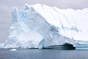
Terrestrial water storage (TWS) is a composition of the water content in vegetation, soil, snow and ice, rivers, lakes, and reservoirs. Hydrological models describe terrestrial water storage (TWS) and its temporal variations, which play a vital role in the water resource management and prediction of climate change extremes like drought and flood. These models solve water balance equations for various TWS compartments, incorporating climate information, land cover, and topography.
To benefit from the Gravity Recovery and Climate Experiment (GRACE) measurement of large-scale TWS variations, the assimilation of GRACE data into the hydrological models has been used for about two decades. However, GRACE-assimilated products computed by different centers contain sufficient differences in space and time. Hence, understanding the differences between the models and their causes is valuable to improving the TWS assimilation models.
To assess the GRACE assimilation outcomes, in situ data of groundwater storage anomaly, river discharge, and soil moisture are typically used. Such data serve as a valuable benchmark, but are poorly observed in many regions.
We use GNSS data for the hydrological model assessment because: 1) GNSS can robustly detect the response of the Earth’s crust to regional TWS mass variation, and 2) there are long-running dense networks of GNSS Continuously Operating Reference Station (CORS) across major river basins worldwide. We use the theory of Greens’ function of the elastic Earth and atmospheric and ocean bottom pressure data products to clean the effect of non-hydrological loading from the GNSS displacement time series. Our GNSS data will also be used to constrain regional TWS variation in an inverse problem.
Organisation and Partners
University of Bonn, Germany
GFZ German Research Centre for Geosciences Potsdam, Germany
Technical University of Munich, Germany
DLR German Aerospace Center Oberpfaffenhofen, Germany
Goethe University Frankfurt, Germany
HafenCity University Hamburg, Germany
University of Stuttgart, Germany
University of Hohenheim, Germany
Project team